Archive for the ‘Expeditions’ Category
Posted by derrick on
July 14, 2008
Weather day. Wind blowing in right direction but howling at 40mph plus making even walking difficult at times. Most fishing boats stayed in
port today. Good to have shower & salt streaked clothing laundered. Still no cell coverage or internet access. Winds expected to drop tomorrow
Posted by derrick on
July 14, 2008
N51 23.0 W56 34.7 Green Island Cove. 51K. Fair winds but strong current slowed progress. Sleeping in huge fishing shed. ATVs buzzing outside.
Posted by derrick on
July 13, 2008
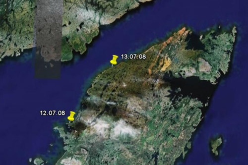
N51 03.0 W56 58.3 Dog Cove. 60K. Beautiful warm sunny day light winds. GPS & compass didn’t jive today. Later found that cans of salmon under deck (below compass) were the culprit. Labrador coast in sight! Thunderstorms off Labrador are booming in the distance. Close encounter with Fin whale. Camped in lovely meadow but mosquitoes out in force.
Posted by derrick on
July 12, 2008
N50 43.0 W57 22.1 Port au Choix on Pointe Riche Peninsula. 60K. Strong winds from SW building to F7. I had my hands full at Pointe Riche with an almost fully developed sea with large 8 to 10 foot rollers. Big stuff but waves not feeling bottom so few breakers but kayak decks often awash. Camp in protected harbor near Phillip’s Garden a 2400 year old Paleo Eskimo site.
Posted by derrick on
July 11, 2008

N50 14.42 W57 35.39 Daniel’s Harbour. 73K. Blustery following seas. Sunny most of day. Favorite moment: heavy rain matted down sea while large rollers from behind surged me forward, staying warm and dry in drysuit/kayak. Fisherman saw me come ashore & is letting stay in his shed. Rain & wind is howling loudly outside.
Posted by derrick on
July 10, 2008
N49 42.2 W57 56.97 Gros Morne. 65K. Spectacular cliffs along Cape St Gregory. Cliffs concentrated moderate SW breeze into a screaming 45mph plus tailwind. Tops of waves blown off & surface of water streaked by violent gusts. Not very serene but good for surfing 7 plus knots. Camp on low coast. Blackflies fierce & chased me into tent early.
– – –
This is derrick. . just a side note that I’m traveling myself now for the next two weeks so I may not get the google maps up until I’m at a hotspot.
Posted by derrick on
July 9, 2008
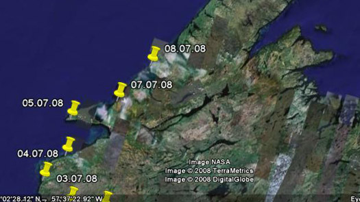
N49 17.1 W58 15.1 Beverly Cove. 62K. Pleasant sunny day. To prevent overheating needed to vent drysuit with neck ring & put PFD on aftdeck (clipped to skirt). Black bear watched me land at campsite from top of ridge. As soon as I exited kayak & stood he bolted into forest.
Posted by derrick on
July 8, 2008
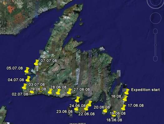
N48 49.3 W58 35.1 Lewis Brook. 84K On the water almost 12hours. Around Port Au Port and across to “mainland”. Lively following seas. Winds strong, some great surfing, linking one wave to the next. This section of coast is tall, rugged & fantastic!
Posted by derrick on
July 6, 2008
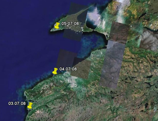
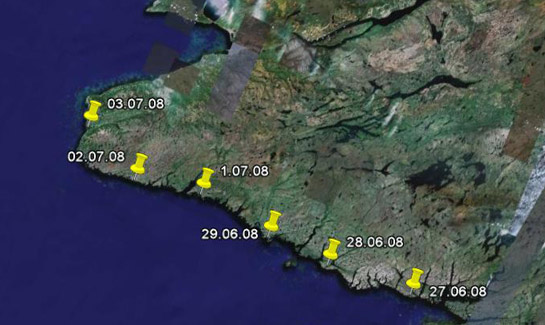
Saturday 7/5/08 N48 28.6 W59 12.66 De Grau. 47k. Crossed St George’s Bay to Port au Port Peninsula. 2 meter breaking beam seas made for a wet, slow & challenging kayaking crossing. Could not land at point due to cliffs, landed just west in a village to buy groceries. Hosted by Laverna & Arsene. Hot shower was pure heaven! Newfoundlanders must be the most hospitable people in the world.
I have been asked why I didn’t portage at the narrow point of land at the Western end of the peninsula. I’m willing to cut corners, cross bays and paddle over anything that will float my boat at high water, but otherwise no portaging (plus that I absolutely hate to portage — probably from portaging my kayak across Isle Royale in Lake Superior to fish the inland lakes).
Sunday 7/6/08 – Strong gusty winds in morning. Decided to give sore muscles a well deserved rest day. All provisions restocked. Invited to a BBQ for dinner!
Posted by derrick on
July 4, 2008
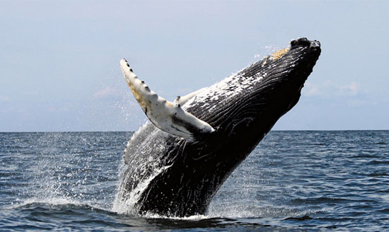
From Greg: N47 45.92 W59 18.69. 63K. Northbound! Rounded Port aux Basques & SW corner. At Cape Ray was treated to a humpback leaping skyward & then crashing down on his side to a thunderous roar. He did this 8 times, once at close range. Camping near small inlet.
* Humpback image by Whit Welles.

