fins
Posted by derrick on June 30, 2008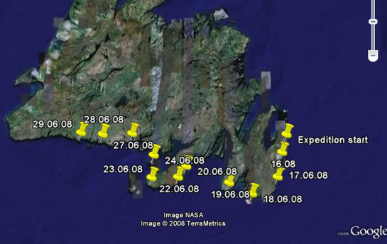

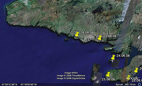
From Greg: N47 35.31 W57 06.25 Grey River. 65k. Overcast but bright with very little fog. Scale of fiords is fantastic. Saw a Humpback whale & 2 eagles. Re-provisioned food in Grey River. Kayak pulled up next to fishing boats. . . looks like part of the fleet.
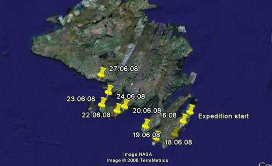
From Greg: N47 36.73 W56 23.73 Richard’s Harbour. 63k. Rain & fog. Double crossing of Fortune & Hermitage Bays. Many whales, blow spouts everywhere. Whale surfaced within 30 feet of kayak! Boat repairs worked day hatch bone dry.
– – –
This from MR. STAMER; Another weather day on Brunette island. Winds dropping. Expect to cross to S coast tomorrow. Beautiful sunny day. Took opportunity to make boat repairs. Day hatch compartment was leaking thru bolts in bulkhead. Applied caulk. Also fixed chine gel coat damage from rock impact with epoxy putty.
– – – – –
In sea kayaking it is generally accepted that leaks. . . are bad.
From Greg: Hunkered down in strong, gusty winds. Sea is a mess of whitecaps. Hìlleberg tent doing a great job. Hiked island and replenished water from large interior lake. No sign of lone bison reported in past years. Landscape is green rolling hills, untamed by fences & replenished and bordered by the sea. Stunning & soul renewing.
(Force 7? White Caps? and he’s on land communing with nature?? Bah! I say!. . . .)
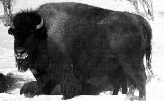
Brunette Island, 20 km2, is situated at the mouth of Fortune Bay on Newfoundland’s Southern coast, 18 km South of Connaigre Head. Residents of the Island were relocated to the mainland in the late 1950s, and since then Brunette became a provincial wildlife reserve. Over the years the government has started experimental colonies of Caribou, Arctic Hare, Moose and . . . Bison. Apparently they all lived happily ever after. . well, other than the bison.
Greg arrived on Brunette Island under heavy fog and light rain. He fully guyed out his tent in anticipation of storms and winds up to F7 plus tomorrow. Sounds like a weather day. He reports that a whale spoutedd close to his kayak today. . . and that he’s looking forward to sleeping in. . . all cozy warm in his tent. . . curled up with a Caribou, an Arctic Hare, a Moose, and a Bison. . .

Read More about Brunette Island.
*top image by John Hill, 1971.
From Greg – heavy, dense fog. Only dark glimpses of land. Light winds. Saw a small whale! Paddled late into the night due to the lack of landing spots. Covered 57k.


After a rest day Greg jumped right back into the fray. He battled intense F5 plus headwinds and for most of the day made only 1 to 2 kts. The constant cold winds caused both his contact lenses to dry out at the same time and roll behind his eyelids. He had to switch back to glasses (which can really suck on the water). Through the day the wind and fog would sweep rapidly over and then plummet down the mountain peaks which Greg said was amazing to see. The wind died around 5pm. By the end of the day he made a camp in a small cover near Sauker Hd by a small stream. For the day he managed 33 km.
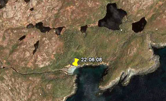
– if you look really closely, you can see Greg skinny dipping in the fridged stream. . . . (N46 54.5 W55 17.9)
Greg checked in with a bit more yesterday – “Resting in Fox Cove. Placentia crossing started with steep following seas. 93km. Was able to surf for the beginning of the trip near Cape St. Mary’s. GPS recorded highest surfing speed of 18.9kts. Winds died midway into crossing Paddled thru the night, and then sun-up (the sun sets around 9:30pm and rises around 4:00am). Bright flashes of bioluminescence on each paddle stroke.”

Placentia Bay is about 50 miles wide stretches inland about 80 miles. We had wondered how Greg would approach it. Now we know. We received a late message; “N47 05.5 W055 06.3 Crossed Placentia Bay 18 hours in kayak. Will take a rest day.” A rest day? I’m not surprised! 18 hours across open water is an incredible achievement for any paddler. We’re all pretty impressed around here, and of course happy Greg made it across without incedent. Neil Burgess shares this; “No one has ever crossed Placentia Bay from Cape St. Mary’s to the Burin Peninsula before in a kayak!”