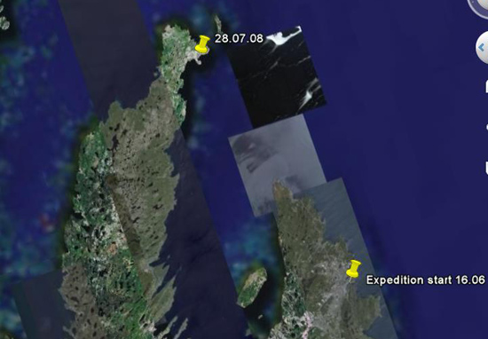
Archive for July, 2008
Posted by Greg on
July 31, 2008
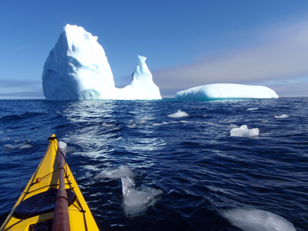
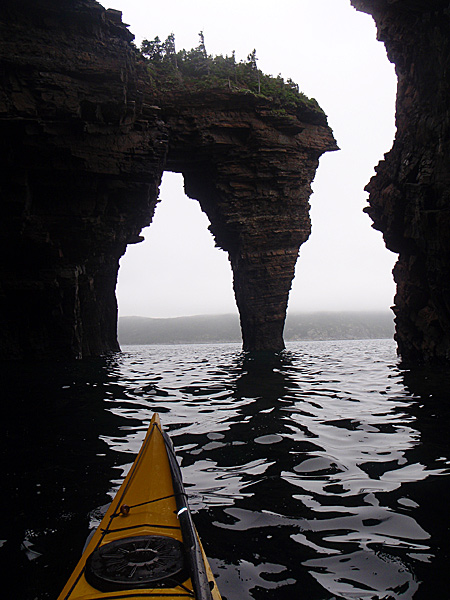
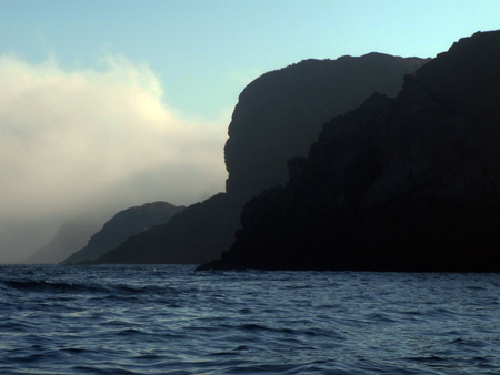
I have many hundreds of images to process but until I return home and have time to edit them, here are a few to give you a teaser of what a beautiful and special place that Newfoundland is. I can understand why many travelers say that a part of Newfoundland always remains in their heart.
Images copyright, Greg Stamer, 2008
Posted by Greg on
July 30, 2008
Following are my trip statistics. I’ll also put a gear list together, along with a list of what gear worked and what gear didn’t make the grade.
Total distance paddled: 2102K (1306 miles)
Daily average: 60.05K (37.3 miles)
Longest day: 93K (57.8 miles)
Shortest day (aborted crossing of Trinity Bay): 27K (16.7 miles)
Total days: 44
Paddling days: 35
Weather/Rest days: 9
Many hundreds of whales, dolphins and blowspouts! Two sharks and two sunfish. And of course, and most important, too many life-changing memories to list…
Posted by Greg on
July 29, 2008
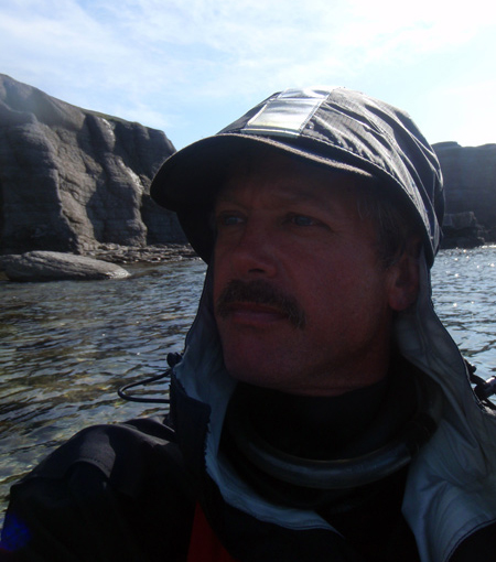
Today was borderline for the final crossing — gusty headwinds and choppy seas. The conditions weren’t unsafe but were a difficult slog with the kayak pounding hard and “buckets” of water frequently hitting my face and chest. At 8:00PM, after 12 hours and 63K I approached Quidi Vidi (pronounced “kiddie viddie”) where I started my trip 44 days ago. Just outside of the rocky, narrow fishing harbor I was met and escorted in by two kayakers from KNL (Kayak Newfoundland Labrador). It brought a smile to my face as did seeing the KNL members who gathered in the harbor and cheered as I took my last paddle strokes. Many thanks to everyone who participated, it really warmed my heart!
It felt strange to unload the kayak and split up my gear. It felt like disbanding a “team”. This gear has been my sole material world for so long that it hasn’t fully sunk in that I won’t be repacking it again early in the morning to push toward another distant destination. That said, tonight I am looking forward to falling into a real bed! Read more... (312 words, 1 image, estimated 1:15 mins reading time)
Posted by derrick on
July 29, 2008
N48 05.13 W52 53.8 Bay de Verde. On water at 6:30am, 10 hours to cross Trinity Bay & reach split point. Morning was strong headwinds & 1.5 meter seas. Kayak was pounding hard & throwing spray. Wind died in afternoon, fog turned to sun making for pleasant conditions. Looking forward to final crossing & finishing tomorrow!
Posted by derrick on
July 28, 2008
Weather day waiting on wind to drop. Hope for a window early in morning. Got my first hot shower in over a week. Heaven! A trip like this really makes you appreciate the modern comforts that are taken for granted. Hosted for the night & treated to a jiggs dinner (salt beef, cabbage, potatoes, turnips). Rested & fed. Hard to wait when you are in “overdrive” & raring to go.
Posted by derrick on
July 26, 2008
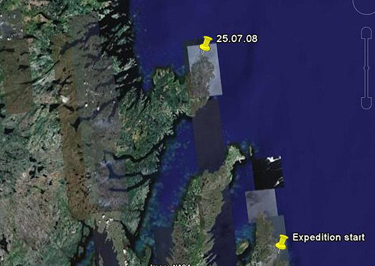
N48 39.6 W53 04.02 Spillars Cove. 85K. 14 hour crossing of Bonavista Bay. Calm & sunny. Surrounded by whales & dolphins for most of day.
Posted by derrick on
July 25, 2008
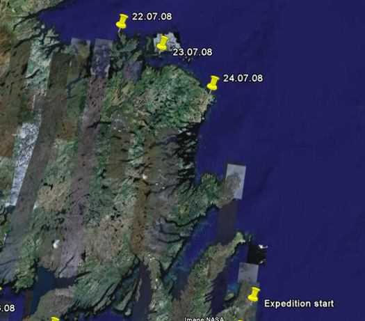
N49 16.5 W53 32.2 Brandy Cove near Cape Freels. So many whales leaping & crashing down in distance near Muddy Cove that it sounded like fireworks. Drysuit neck gasket gave up the ghost & split, good thing trip almost done. 62K today. Camped on a soft, thick bed of crowberry.
Posted by derrick on
July 24, 2008

N49 33.55 W54 14.95 Western Indian Island (near Fogo). 50K. Beautiful warm sunny day (very hot in drysuit). Change Islands & Fogo area is a beautiful archipelago. Curious marine patrol boat intercepted me and came alongside. They said that they simply couldn’t figure out what kind of craft they were viewing from the distance. The officers were polite, we chatted, and they took a pic before they went off. They were out to monitor the recreational cod fishery that opened today. It seems that everyone who owned a boat was out today for their hand at jigging cod.
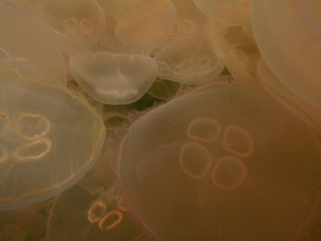
I thought that I was about to strike a pink-colored shoal when I discovered that I had entered a cloud of jellyfish. Literally millions of them! Dipped the camera underwater for some images and hope that they turned out.
Posted by derrick on
July 23, 2008

Greg – N49 41.04 W54 48.36 Sleepy Cove, Batrix Island. 77K open water crossing in 12hrs. Scores of whales, some leaping out of water. Saw at least 100 blow spouts. Picture perfect camp on ridge overlooking natural harbor.
Posted by Greg on
July 21, 2008
I’m in a public library in La Scie, a small fishing village at the tip of the Baie Verte Peninsula. It’s good to finally be off the long Northern Peninsula and moving East! Yesterday I crossed from the Southern tip of Bell Island, to Bai Verte, 90K of open water. The forecast was not great, calm seas until the afternoon and then headwinds. I got up at 4:30am and was on the water at 6:40. The sea was completely glass and I sprinted at 4.5 knots trying to get as many miles behind me while I could. Once the headwinds come up and your speed drops to 2.5 knots or less it takes forever to cover ground and it really wears you down. I was hoping that the forecast would be wrong but the headwinds started around 2:00pm and were howling by 5:00pm, with steep, choppy waves. After 16 hours I reached the tip of the peninsula just as the sun was setting. Unfortunately the two coves that looked so nice on my topo maps and GPS were completely unsuitable for landing – – steep rocky cliffs. It’s hard to describe the emotions you feel at this point. You are completely spent from a long crossing, it is getting dark and cold, you just want to get out of your kayak and stretch your legs, and now you have no idea how long it will take to find a landing. I took the safe route and backtracked a few miles to La Scie, since as a harbour I knew that I would at least find a place to haul out, and aids to navigation to guide me in. Read more... (642 words, 0 images, estimated 2:34 mins reading time)


